Habitat Restoration
Sometimes, the best thing to do for the land, and the plants and animals that live there, is to let it be. In other cases, we may find that improvements could benefit the land for water quality, wildlife or for recreation.
Natural habitats provide a wide range of ecosystem services – the benefits that people obtain from ecosystems. Wetlands and streamside forests remove pollutants from water and reduce the risk of flood events. Prairies support pollinator species, which are needed for about 35% of our food crops. Trees and other vegetation remove carbon dioxide from our atmosphere and create the oxygen we all need to survive.
Black Swamp Conservancy works to restore natural habitats in strategically sited locations that will have the most benefit on water quality and wildlife species. Often, this work occurs on frequently flooded streamside lands that are marginal for agricultural production. Below is a list of habitat restoration projects the Conservancy has completed. More projects like these are currently in progress.
Forrest Woods Nature Preserve / Forder Bridge River Access Restoration Projects
2016 – 2017 Restoration
As The Conservancy purchased Forrest Woods Nature Preserve in multiple transactions beginning in 2002, it acquired several agricultural fields surrounding the old-growth wooded wetland at the center of the property.
In 2016 and 2017, we completed our first restoration project on the site.
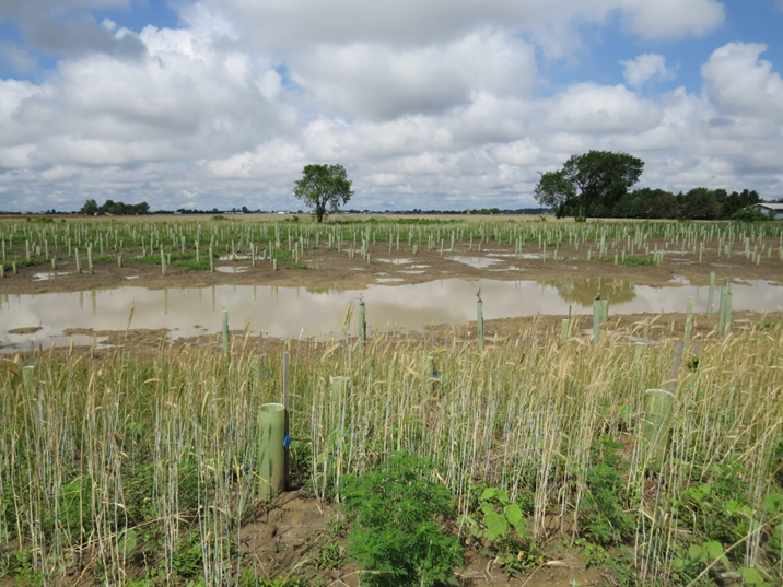
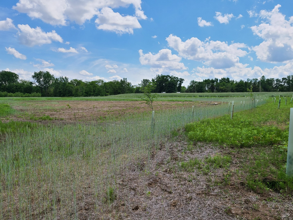
This restoration converted 120 acres of the property back to natural habitat, with a focus on returning wooded wetlands and upland forest to the landscape. In total, more than 16,000 trees were planted as part of this project, and ¾ mile of agricultural drainage ditches were returned to functioning streams.
Before 2017 Restoration

After 2017 Restoration
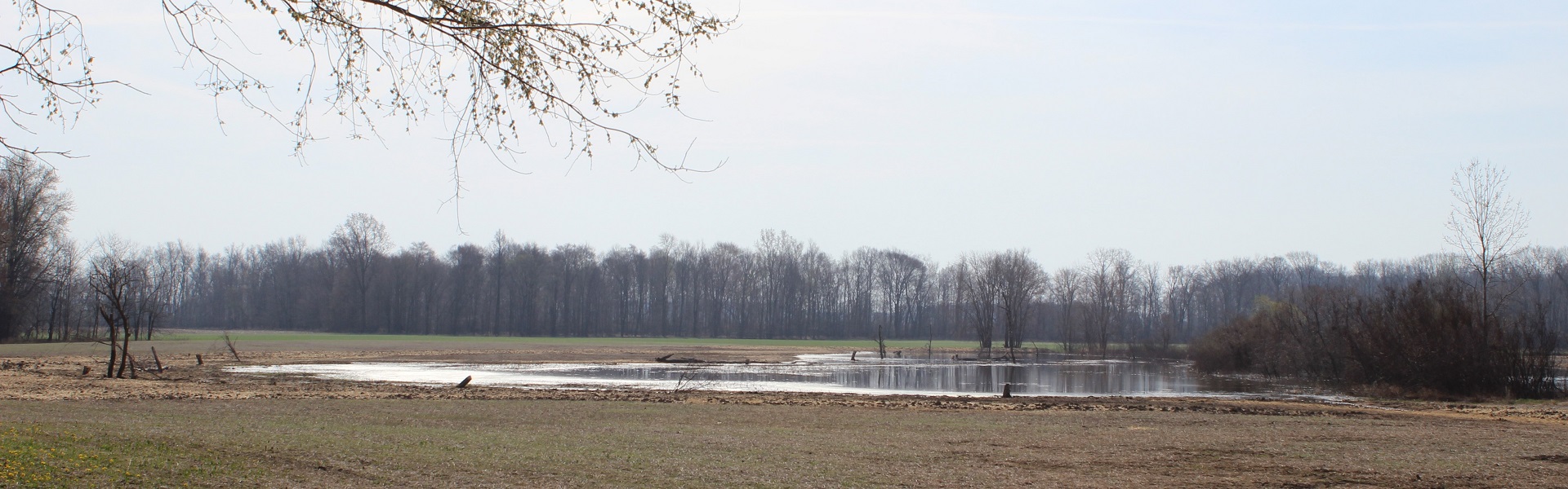
Forrest Riverlands Restoration
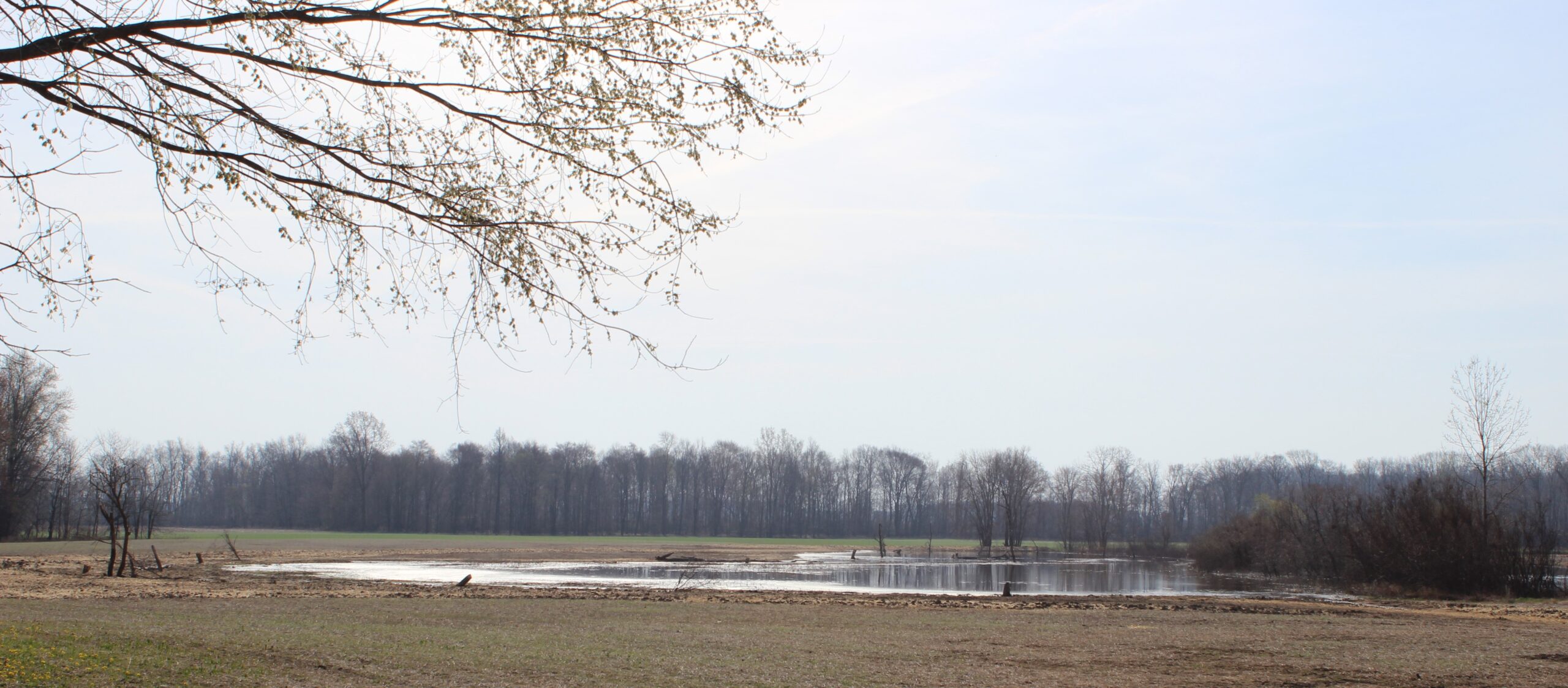
This riverside portion of the preserve was farmed until 2017, despite being flooded every spring when the river runs high.
The Conservancy took this key riverside tract out of farm production, restored a ditch to a natural channel, and planted native wetland plants and trees that are a crucial part of natural riverside plant communities. These riverside trees and wetlands improve water quality by filtering out excess nutrients and sediment and by shading the river. They provide important shelter and food for all kinds of wildlife using the river corridor.
The new habitat restored here will also buffer the old-growth woods at the core of Forrest Woods Nature Preserve, creating more stability for this biodiversity hotspot.
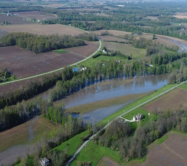
Pre-Restoration Forrest Riverlands Flooding
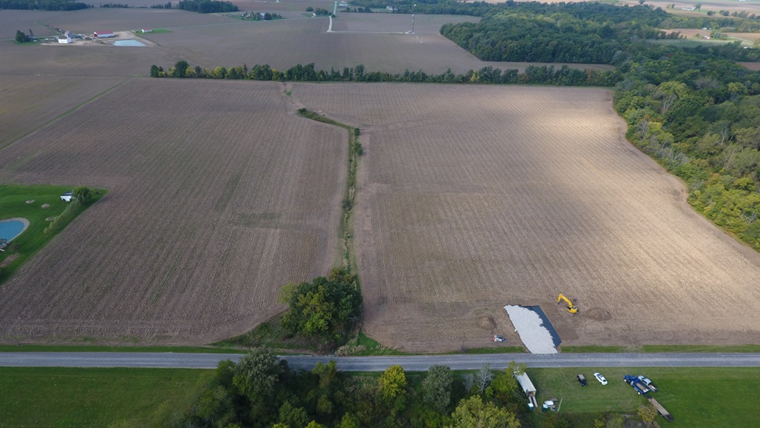
Forder Bridge H2Ohio Restoration
The Forder Bridge tract of Forrest Woods Nature Preserve is a 54-acre parcel that provides public access to the Maumee Scenic River. A small, seasonally flowing stream flows through the property and into the Maumee River. The upper section of the stream was confined to an underground pipe to facilitate farming of the site in the past. This pipe also moves water from neighboring farm fields into the river.
To capture all that farm runoff before it flows into the river, the Conservancy created a series of four wetland pools and broke the pipe in multiple locations. The water now fills these four pools and slowly flows through berms that lie between them, and then finally into the small stream. The stream was also restored by adding gravel and shoring up the banks. The cleaner water flows from the wetland chain, into the restored stream and slowly meanders down to the river.
As an additional part of the restoration project, we also installed other wetland pools in the floodplain of the Maumee River. One large wetland that will hold water most of the year is located right by the parking lot and the newly improved canoe/kayak boat launch. This has been a perfect spot to install educational signage to let our preserve visitors learn more about wetlands.
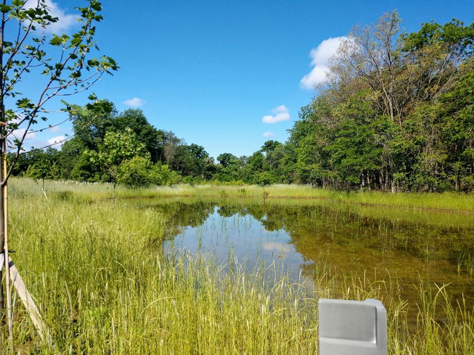
Restored Wetland at Forder Bridge
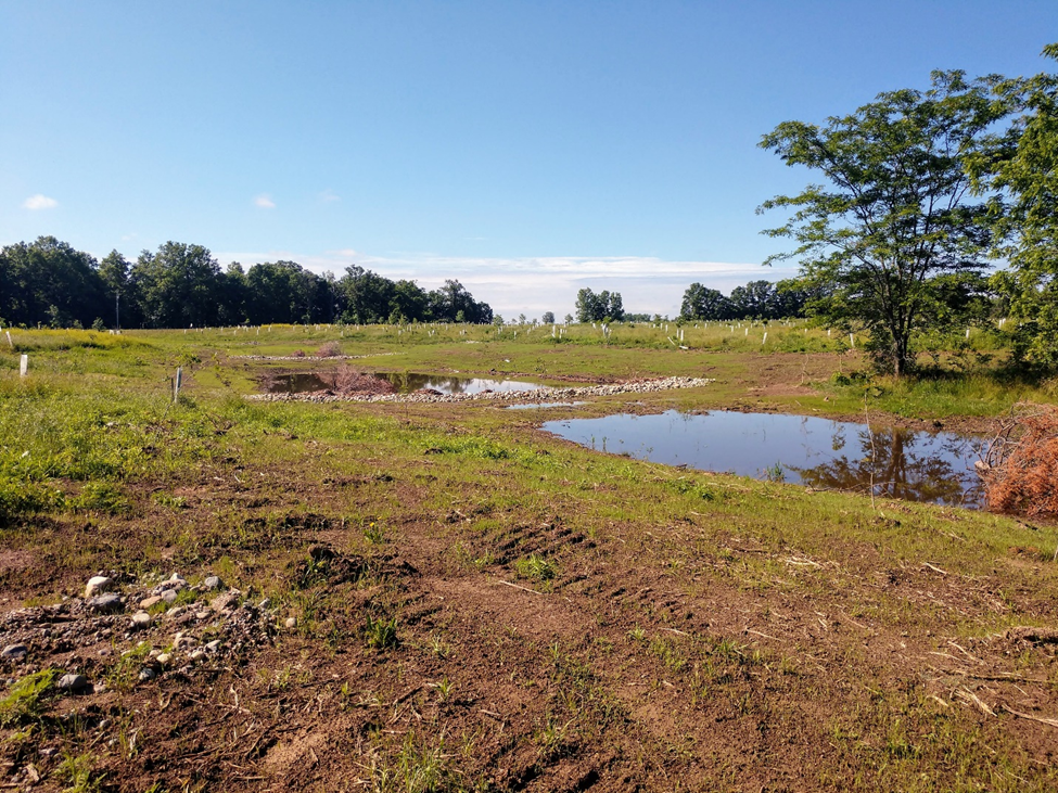
Restored Treatment Chain Wetland at Forder Bridge
Carter Historic Farm Restoration Project
Wood County Park District’s Carter Historic Farm was established in 2000. The family that donated the land to the Park District also donated a perpetual conservation easement to Black Swamp Conservancy to ensure it would always be maintained as agricultural land and natural habitat. In 2017, the Park District partnered with the Conservancy to plan a wetland restoration on the back end of the Farm.
The new wetland, completed in 2019, is situated along the drainage ditch that farm runoff flows into. Water that once flowed through farm drainage tiles directly into the ditch now gathers in the wetland where native wetland plants filter out excess nutrients. Cleaner water leaves the wetland and makes its way into Toussaint Creek.
The new wetland sits alongside an older wooded wetland, so now there is a larger block of habitat for frogs, birds and other wildlife to use. This project is intended to showcase how agricultural lands and natural habitats can co-exist and support clean water in the Western Lake Erie Basin.
Carter Farm Before Restoration
Carter Farm After Restoration
Redhorse Bend Restoration Project
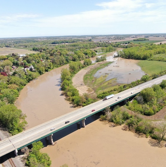
Redhorse Bend Nature Preserve lies along an almost 1-mile-long bend in the Sandusky River on the north edge of Fremont. In 2019 and 2020, in partnership with the Ohio Department of Natural Resources, the Conservancy converted 54 acres of frequently flooded farmland into riparian (riverside) seasonally wet floodplain wetlands and riparian and upland meadows.
These restored habitats will benefit Fremont’s people and environment while also improving the quality of water flowing through the Sandusky River and into Sandusky Bay and Lake Erie. Instead of crops, the former farm field will now produce “ecosystem services,” like filtering nutrient-loaded floodwaters, creating habitat for pollinators, and offering us new ways to connect with nature.
The new wetlands that were created on the farm field are adjacent to already established habitats, like mature forested wetlands. This 93-acre preserve is now a large, connected habitat, along the river corridor…perfect for supporting colorful wildflowers, native grasses, shrubs, and trees, as well as lots of wildlife that rely on wetlands and river floodplains. In the seasonal pools of the riparian wetlands, we already have waterfowl, small fish such as shiners, and amphibians, such as bullfrogs and leopard frogs. The newly planted meadows will host sparrows, warblers, meadow larks, and pollinator species such as butterflies and bumblebees.
How will the nature preserve make cleaner water?
In the past, when the Sandusky River flooded the fields or rain fell upon them, the water would carry soil directly into the Sandusky River through drainage ditches. That soil often included excess nutrients from fertilizer, which can feed algal blooms in Lake Erie that can kill fish, harm our pets, and make water unsafe for drinking and recreation.
Now, the preserve has berms (raised areas) that guide floodwaters and stormwater into shallow pools, where it will slowly seep into the ground and nourish native plants that help filter out excess nutrients and pollutants. The parts of the field adjacent to the river are now a more natural, vegetated floodplain, which will also absorb and retain nutrients, while also providing habitat for wildlife along the river.
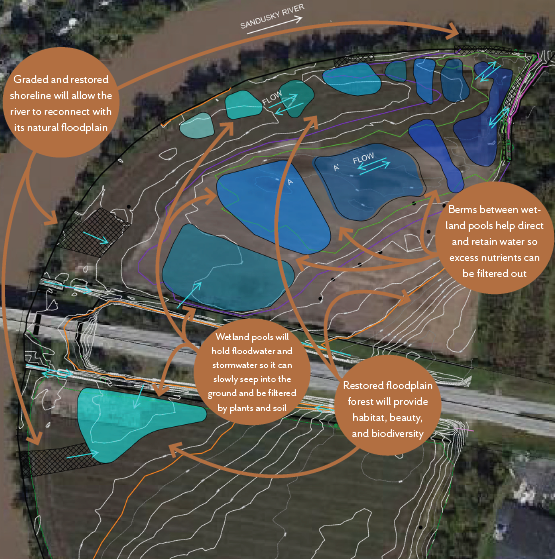
Redhorse Bend Restoration Design
Post-Construction Restoration at Redhorse Bend
St. Joseph Confluence Preserve
The Conservancy purchased this 140-acre nature preserve in 2019. It is located in Williams County, and at the heart of the preserve is the confluence of the East and West Branches of the St. Joseph River. The preserve protects over a mile of the St. Joseph River and its tributaries and an assemblage of exceptionally high-quality wetlands and riparian (riverside) habitat. About 50 acres of the site was in row crop production and a low-diversity meadow planted under the Conservation Reserve Program (CRP). In partnership with ODNR, the Conservancy restored these 50 acres of agricultural land back to native wetlands, oxbows and woods.
An exciting part of the restoration was restoring an old oxbow of the St. Joseph River. Long ago, the river flowed through the field, but then it changed course, leaving behind an oxbow wetland. When the river was high, its waters would overtop the new banks and flow into the oxbow, maintaining the water needed to keep the wetland healthy. When people started farming the land, they needed to keep that water off the field, so they added concrete and rocks to raise the banks of the river to stop the water from its natural course of flooding into the old oxbow.
Now part of the nature preserve, the field will not be used for farming anymore, so we wanted to restore this natural hydrology (or water movement). We removed the concrete and rocks from the river banks, bringing them back down to their more natural heights. Now, when the river is in flood stage, its waters can again flow onto the field and into its old oxbow wetland, where the waters slow down and can slowly seep into the soil and be filtered by native plants.
An agricultural ditch that drains water from nearby farms was given the same treatment, so its waters can also flood onto one of the restored fields and slowly seep through the newly created wetlands there, before entering the St. Joseph River.
This nature preserve was once home to the rare and federally threatened species, the Copperbelly Watersnake. The snake hasn’t been seen on this site since the 1980s, but a population lives nearby at Lake La Su An State Wildlife Area. When we designed our restoration for St. Joseph Confluence Preserve, we kept these snakes in mind, and created spots with the kind of habitat they like: bushes and small trees on the edges of wetland pools, and lots of crayfish burrows which is where this watersnake hibernates through the winter! Since this large nature preserve’s old forested wetland habitats are now connected to even more wetlands thanks to this restoration, we hope the rare snakes might find their way to this safe haven again someday.
Restored Oxbow Wetland at St. Joseph Confluence Preserve
St. Joseph River Food & Floodplain Restoration Project
In 2019, Black Swamp Conservancy purchased a 94-acre farm containing agricultural fields, mature forest, and forested wetlands along the St. Joseph River. The majority of the farmland on the property was located within the floodplain of the St. Joseph River.
In partnership with the Ohio Department of Natural Resources and EnviroScience, Black Swamp Conservancy converted 57 acres into floodplain, wetland, stream, and forest habitats. A portion of the original farmland, located outside of the floodplain, was enrolled in the Conservancy’s Food and Farm Initiative, which supports beginning farmers that utilize sustainable practices by leasing land at below-market rates.
Restoration of the property involved the creation of eight wetlands and more than 2,200 linear feet of stream. Over 80 species of native plants were planted, including three seed mixes, more than 10,000 trees, and 4,000 live stakes. As water flows onto the property from adjacent farmland, it enters the stream and travels through a series of wetlands. Slowing down this agricultural runoff and allowing it to contact the native plants will remove sediment and nutrients before they reach the St. Joseph River.
Restored Wetland at St. Joseph Food & Floodplain Preserve